Blog Article List Home Contact Me
|
Wilkes:
spring, Wagoner, grants September 16, 2020 Big Rock Spring It’s exciting when today’s discoveries
support information that was recorded long ago. There are certain landmarks that are so
noteable or unique that even the earliest settlers were inclined to reference
them in their documents. The fact that
we are able to visit these same landmarks today provides us with a link to
the past. One of the most obvious examples of
this is Stone Mountain in Wilkes County.
Early land records referred to it as the “Great Rock Mountain”, but
soon the concensus became “The Stone Mountain”. Another example that I recently discovered
is the “Big Rock Spring”. I hadn’t
heard of it before joining two other hikers to go see it in the northwest
corner of Stone Mountain State Park. When we arrived at the site, it was
clear how it got its name: it’s a big
rock with a spring flowing from the bottom of it. The rock base is split wide enough for a
stream of water to flow through. This
is part of the headwaters of Harris Creek.
And a view looking up the spring to the
base of the Big Rock.
When I’m hiking I always think about
who the early landowners were. Whose rock
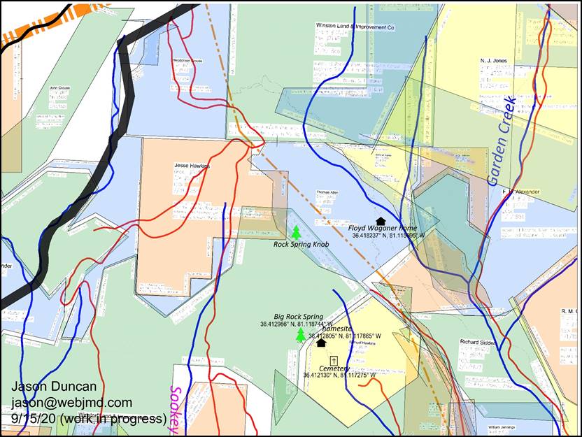
spring was this before it became part of the state park? I pulled up my map to the general area and
zoomed in on the original land grants.
On the map below, the dark line at the left is the county line. Garden Creek is at the right. The Big Rock Spring is marked with a tree
toward the bottom.
To my surprise my own map had a
reference to this natural feature! The
yellow, hexagon-shaped grant was entered by Samuel Hawkins in 1854. It consisted of 58 acres on the waters of
Harris Creek, “near the Big Rock Spring”.
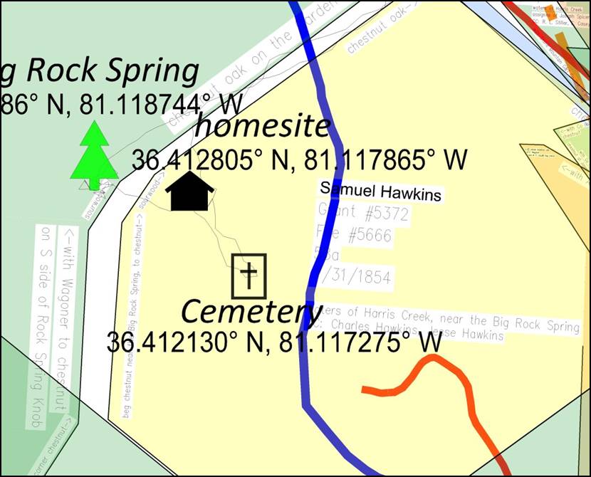
A larger version of the map
is available to make it easier to read the text. The southwest corner of the property was
marked by a chestnut near the Big Rock Spring, and that boundary headed north
to another chestnut. Just 100 yards to
the east are indications of an old cabin and homesite. Another 100 yards southeast is a small
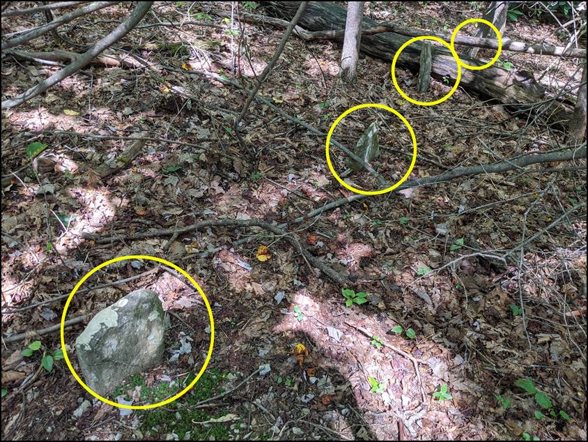
cemetery with at least four markers as shown below.
So who might be buried in this
cemetery? Could it be the Samuel
Hawkins family? He bought the land in
the 1850s as the first landowner, but I found that there were several other
landowners in the following decades. On 3/14/1860, Samuel Hawkins sold it to
Charles Hawkins who must have been a relative. But Charles didn’t keep it very long. The next year he sold it to John Willey. Five years after that, in 1866 John Willey
sold it to Martin Willey. Within a 6
year span, there had already been four different landowners! Martin Willey kept it for eighteen
years. In 1884 he sold these 58 acres
to Louisa Wagoner. On that same day
she mortgaged the property to pay for it, borrowing from Adam J. Moxley. On 6/27/1890 Louisa Wagoner sold the
rights to the timber to G. W. Hinshaw who would was, or would soon be, the
president of the Winston Land and Improvement Company. Between 1890 and 1910, George Hinshaw and
his company bought thousands of acres around Stone Mountain and the Gamelands
for the timber and minerals. By the
mid 1900s, the company wasn’t using the land and much of it was obtained by
the state leading to the creation of the state park. By 1894, Louisa Wagoner no longer owned
the land. Either she had died, or
there was a deed that’s been lost from the records. The next deed I found was on 2/9/1894 where
John A. Wagoner sold the land to Floyd H. Wagoner. At that time, adjoining property owners
were William F. Caudill and Adolphus Spicer.
I wasn’t able to quickly find out how Louisa, John, and Floyd were
related, but I’m confident that they were.
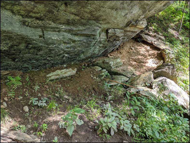
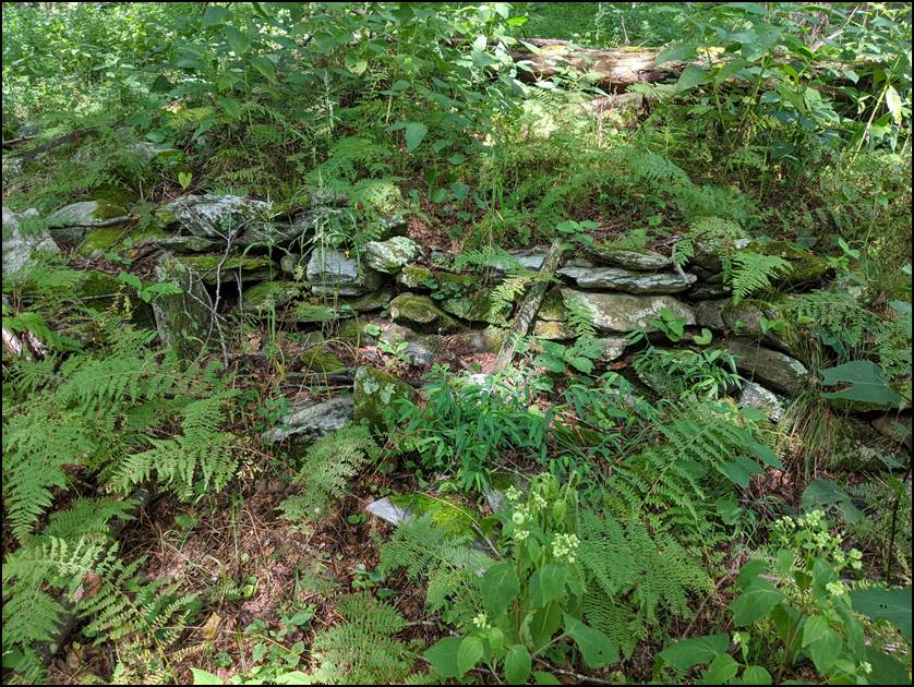
Floyd Wagoner (c1862 -1945) owned
several tracts in the area between the 1890s and 1920. In fact, the remains of his homesite are
located 0.4 miles northeast of the Big Spring Rock. Sometime after 1910, Floyd moved 4 miles
northwest, to the other side of the Blue Ridge Parkway at Whitehead according
to the census. This is a picture of a
foundation or retaining wall at his homesite.
Back to the question about the
cemetery, I don’t think it’s old enough to belong to the Hawkins family. Maybe it belonged to John Willey or Martin
Willey, but my guess is that it belonged to the Wagoners since they owned the
land the longest. Since I’m not sure
what happened to Louisa Wagoner between 1890 and 1894, maybe one of these
graves is her. We need more clues to
solve the mystery. My thanks to Steve and Rick for letting
me join them on the hike. We got to
enjoy nature, get some exercise, and learn a little history, too.
Comments? jason@webjmd.com |
